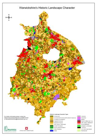
September 2009 saw the completion of the Historic Landscape Characterisation Project. The Project, part of a national programme funded by English Heritage, sought to digitally map the present day historic character of the Warwickshire landscape. HLC provides a broad-brush overview of complex aspects of development of the landscape to stimulate better understanding of the historic landscape resource and its capacity for change, and to establish an integrated approach to its sustainable management in partnership with other organisations.

The project examines changes in the landscape from various sources, primarily historic and modern maps and aerial photographs. Attributes of groups of land parcels exhibiting broadly similar characteristics are identified, and the resulting data is entered onto a Geographical Information System map layer with linked textual information in the HER.

Warwickshire HLC Map
A final project report will be published in Spring 2011 describing the methodology and presenting a detailed analysis of the data (www.warwickshire.gov.uk/hlc). Furthermore, two ‘Toolkits' are being developed to deliver the Warwickshire HLC to wider audiences. It is intended that the HLC will be used by a variety of people including the public, researchers, professional archaeologists, local authorities and many others.

