The Archaeology of Bidford on Avon
Romano-British Bidford

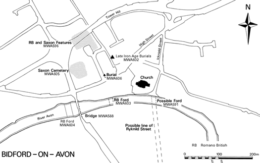
Map of Bidford showing late Iron Age and Roman sites
Details in the HER show that during the Romano-British period Bidford would have been a small settlement along the Roman road known as Ryknild Street. This was an important road that ran north-south through the Midlands. Ryknild Street is still preserved in the current street plan of Bidford; you will know it as Icknield Street.
The road was made from stone slabs set over gravel. Some of this gravel could have come from the Roman sand and gravel quarry located just west of the Roman road.
The gravel would have also been used for river crossings, known as fords, across shallow points in the River Avon. The HER has information for three possible Roman fords in Bidford. These were located as follows
1) to the south of the church
2) 100m east of Bidford Bridge
3) 50m west of Bidford Bridge
To the east of Icknield Street, remains of timber buildings, pottery and rubbish pits were excavated in the 1990s. To the west, Romano-British graves and cremation urns have been located. One of these cremation urns can be seen below.
A Roman Urn found in Bidford

