Historic Environment Record
Description:
The Historic Environment Record (HER) - formerly the Sites and Monuments Record (SMR) - is a record of all the historic and archaeological sites and finds within the county. Accessed through a computer and map based system, the record incorporates a wide range of sources, including aerial photographs, published and unpublished material, and historic and modern maps. It is available to the public and for some counties, like Warwickshire, it is available on the internet (timetrail.warwickshire.gov.uk).
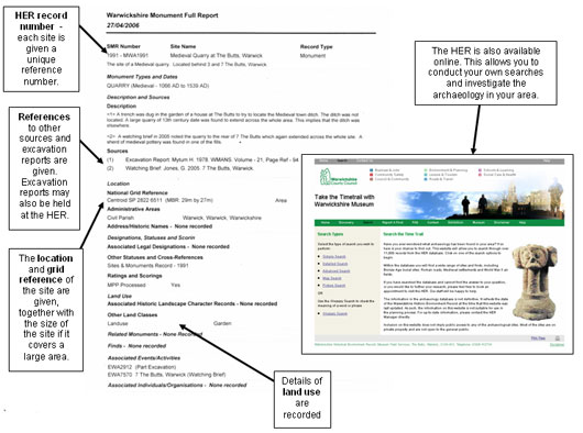
For each site or find the HER provides a location, description, details of any fieldwork done at the site and relevant publications. Information is also held about the status of sites (e.g. whether it a listed building or a scheduled ancient monument). Maps can be produced showing site locations.
Figure 6: HER entry for Medieval Quarry at The Butts, Warwickshire (HER no. MWA 1991)

Copyright: Warwickshire Museum
Click here for larger image
Uses:
The Historic Environment Record (HER) is a good starting point for finding out what historic and archaeological sites have been identified within an area. It can be used to identify relevant secondary sources, and sometimes other primary sources. It may also provide information that is not available elsewhere. The HER can provide a focus and stimulus for further research. The information provided can be used to chart human activity within an area over time, as sites are often classified according to time period and type of activity.
Where to find this source:
- Warwickshire Museum Field Services
- Other County Archaeology Services
- Some availability on Internet

